Navigating a busy city can quickly turn stressful especially when you’re unfamiliar with the area, facing traffic congestion, or dealing with unreliable internet connectivity. This is where 2GIS stands out as a powerful and dependable city navigation app. Designed to offer more than just directions, 2GIS combines detailed maps, real-time traffic updates, offline navigation, and an extensive business directory to help users move confidently through urban environments.
Whether you’re heading out for daily errands, exploring a new city, or searching for nearby services, having a reliable navigation app is essential. Unlike conventional map apps, 2GIS goes beyond basic routing. It provides hyper-local information, 3D city maps, and a built-in “Yellow Pages” experience, making it easier to find businesses, landmarks, and services around you—even without an internet connection.
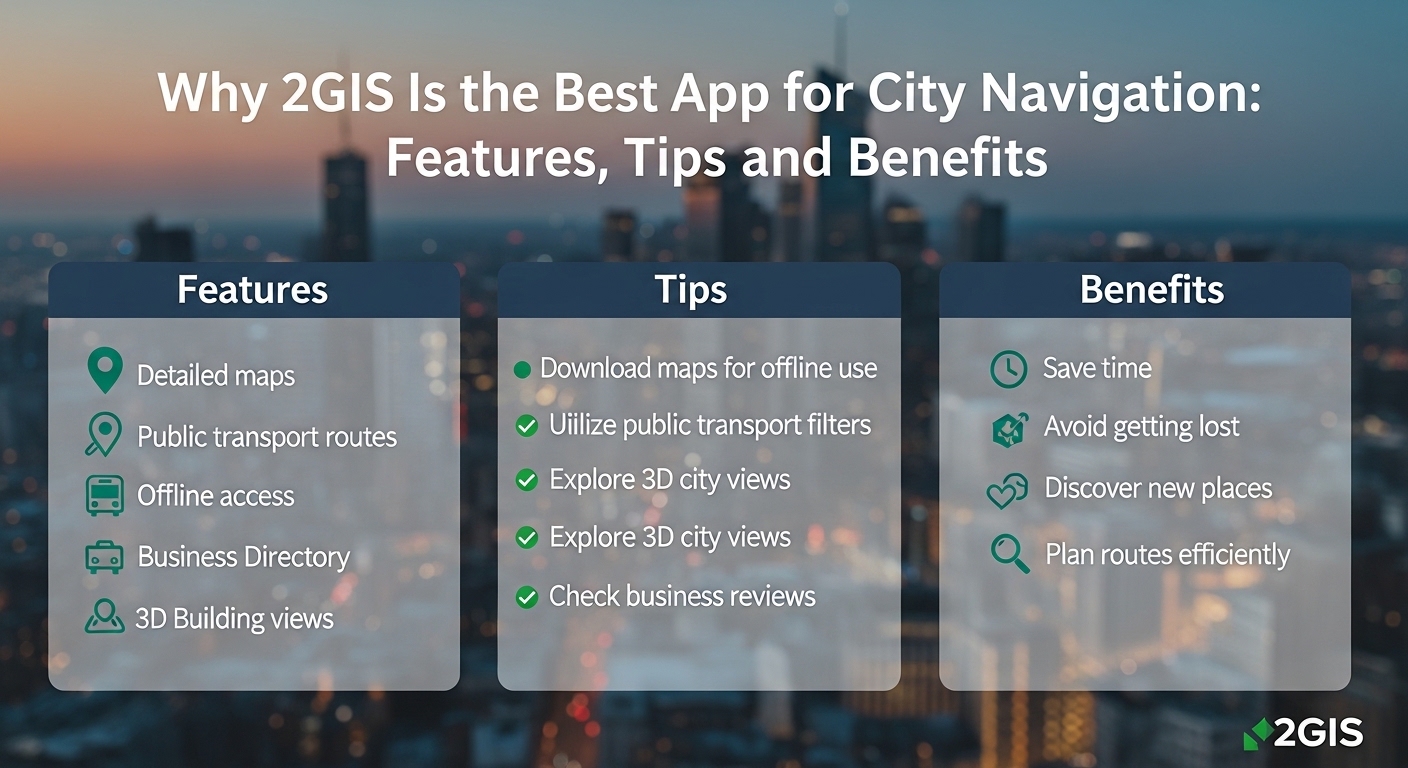
This guide explores why 2GIS is considered one of the best city navigation apps, particularly in regions like the UAE and neighboring countries. We’ll cover its key features, practical usage tips, benefits, alternatives, and even a step-by-step overview of how to build an app like 2GIS.
What Is 2GIS?
2GIS is a comprehensive city navigation and mapping application known for its highly detailed, ground-level view of urban areas. It combines accurate 3D maps, offline navigation, public transport routing, and a massive, regularly updated business directory.
Widely used in regions such as the UAE, Russia, Kazakhstan, Italy, and nearby markets, 2GIS is especially valuable for users who need precise city navigation and reliable local business information. The app works seamlessly offline, making it ideal for travelers, residents, and professionals navigating cities with limited connectivity.
Key Features of 2GIS
2GIS is more than a navigation app—it’s a complete geoinformation system that provides realistic city visualization, verified business data, and multi-mode navigation.
Detailed Offline Maps & Navigation
Complete Offline Functionality
With the 2GIS map download feature, users can access navigation, search, and business directories without an active internet connection. This ensures uninterrupted guidance in areas with poor network coverage.
High-Detail 3D Maps
2GIS offers visually rich 3D city maps that include buildings, fences, driveways, and landmarks. In select cities, users can view prominent structures like the Burj Khalifa in realistic 3D detail.
Indoor Maps
For complex locations such as shopping malls, airports, and train stations, 2GIS provides indoor, floor-by-floor navigation, making it easier to move through multi-story buildings.
Vector Rendering
All offline maps are created using satellite imagery and verified by field specialists, ensuring accuracy and frequent updates.
Comprehensive Business Directory & Smart Search
Verified Business Information
2GIS AE functions as a reliable business directory, offering up-to-date details for millions of organizations, including addresses, phone numbers, working hours, and services.
Advanced Search Capabilities
The intelligent search engine handles typos, incomplete queries, and colloquial business names, ensuring users find relevant results quickly.
Detailed Business Profiles
Each listing includes entrance locations, payment methods, social media links, photos, and user reviews—providing all essential information in one place
Advanced Navigation and Traffic Features
Multi-Modal Routing
2GIS Dubai supports navigation for driving, walking, and public transport, offering optimized routes for each travel mode.
Public Transport Guidance
The app displays accurate transit routes, schedules, and nearby stops, making it easy to navigate buses, metros, and trams.
Real-Time Traffic & Road Events
Users receive live updates about traffic congestion, accidents, road closures, and speed cameras to help avoid delays.
Truck Navigation
Designed for cargo and logistics, the truck navigation mode considers vehicle size, weight, and road restrictions.
Voice Navigation
Turn-by-turn voice guidance allows hands-free navigation, improving safety while driving or walking.
Specialized Tools & Additional Features
- Parking Information: Find nearby free and paid parking spots easily.
- Friends on the Map: Share your location and view friends’ locations in real time.
- Floors Feature: Navigate inside large complexes using detailed floor layouts.
- API & SDK: Developers can integrate 2GIS maps, search, and navigation into third-party apps and websites.
Multi-Platform Accessibility
- Mobile Apps: Available for iOS and Android, with Android Auto integration.
- Desktop & Web: Access 2GIS via Windows desktop software or a browser-based version for convenience across devices.
How to Install and Use 2GIS
How to Install 2GIS
Mobile Installation
Download 2GIS from the App Store (iOS) or Google Play (Android). The app is free and installs quickly.
Initial Setup
On first launch, download the map for your current city to enable offline use.
System Requirements
- iOS 8.0 or later
- Android 4.4 or higher
How to Use 2GIS
Download Offline Maps
Access the “List of Cities” menu to download maps for offline navigation.
Navigation
Enter your destination and choose your transport mode—driving, walking, or public transit. Navigation works seamlessly offline once maps are downloaded.
Search Functionality
Search for addresses, businesses, phone numbers, and operating hours—even without internet access.
Tips for Using 2GIS Effectively
Offline Map Management
- Download maps in advance for uninterrupted navigation
- Update maps regularly for accuracy
Advanced Route Planning
- Customize transport preferences
- Identify building entrances
- Manually adjust routes
- Monitor live traffic and forecasts
Detailed Search & Filtering
- Search by category or business name
- Use filters to find top-rated places
- Access advanced analytics with 2GIS Pro
Specialized Features
- Track Recording for route history
- CityLens for advanced driver assistance
- Language switching for regional convenience
Urban Navigation Solutions (Dubai Focus)
2GIS is particularly effective in Dubai, where road networks can be complex. It supports:
- Understanding E and D road systems
- Precise navigation through intricate city layouts
- Accurate directions in high-traffic zones
Key Benefits of Using 2GIS
Offline Accessibility
Navigate, search, and explore business listings without consuming mobile data.
Detailed Mapping
3D visuals, indoor layouts, and realistic landmarks enhance navigation accuracy.
Extensive Business Directory
Access verified information on millions of businesses in one app.
Reliable Navigation & Transit
Accurate routes, real-time traffic, and public transport schedules improve travel efficiency.
Powerful Search
Find places quickly using flexible and intelligent search options.
Top Alternatives to 2GIS
- Google Maps: Global navigation with Street View and Google integration
- Waze: Community-driven traffic updates
- HERE WeGo: Strong offline navigation support
- Yango Maps: Navigation combined with ride-hailing
- Organic Maps: Privacy-focused offline maps
- S’hail: Dubai-specific public transport app
Step-by-Step Guide to Building an App Like 2GIS
- Define core features (maps, navigation, directory, offline mode)
- Conduct market and competitor research
- Choose a scalable tech stack
- Develop 3D and offline map functionality
- Integrate traffic and navigation APIs
- Build a verified business directory
- Add user accounts and personalization
- Ensure scalability and performance
- Perform thorough testing
- Launch and market the app
- Maintain and update regularly
Tech Stack for Developing an App Like 2GIS
Includes:
- Frontend: React Native, Flutter, Swift, Kotlin
- Backend: Node.js, Python, PostgreSQL with PostGIS
- Mapping: Mapbox, OpenStreetMap
- Cloud: AWS, Google Cloud
- Analytics & Security: Firebase, Sentry, SSL
Cost to Develop an App Like 2GIS
- Basic Version: $30,000 – $60,000
- Advanced Version: $80,000 – $150,000+
- Enterprise Version: $200,000 – $400,000+
Costs depend on features, platforms, APIs, design complexity, and maintenance.
Leadsin: Leading App Developers in the UAE
Leadsin stands out as one of the leading mobile app development company, known for creating high-quality, innovative, and user-friendly mobile applications.
With a deep understanding of the region’s market needs and user preferences, we as the best mobile app development company in UAE, specialize in crafting apps that are tailored to meet the unique demands of businesses across various industries.
Whether it’s developing cutting-edge features for e-commerce, real estate, healthcare, or entertainment, Leadsin is one of the best mobile app development agency in Dubai that combines the latest technology, seamless user experiences, and robust functionality to deliver exceptional mobile apps.
The expert mobile application development team is committed to ensuring that each app not only looks great but also performs optimally, providing businesses
with the tools they need to succeed in today’s competitive digital landscape. With a focus on security, scalability, and user engagement, Leadsin continues to be the go-to partner for businesses looking to leverage mobile technology to enhance their services and customer experiences in the UAE.
Conclusion
2GIS is a powerful, feature-rich city navigation app that excels in offline functionality, 3D mapping, real-time traffic updates, and comprehensive business directories. Whether you’re driving, walking, or using public transport, it delivers reliable navigation and local insights—making city travel smarter and stress-free.
FAQs
Q: What makes 2GIS different from Google Maps?
2GIS offers offline navigation, detailed 3D maps, and an integrated business directory focused on urban environments.
Q: Is 2GIS free to use?
Yes, 2GIS is completely free, including maps, navigation, and business listings.
Q: Can I use 2GIS offline?
Yes, simply download city maps within the app for full offline access.
Q: Does 2GIS provide real-time traffic updates?
Yes, it includes live traffic data to help users avoid congestion and delays.